What is location ratings
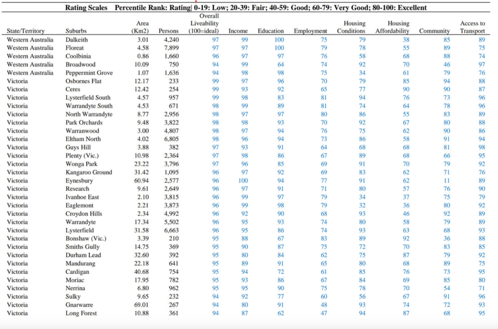
Location ratings data is a suit of quantitative indicators to measure the socio-economic dimensions of 15,000 suburbs, local government areas and postcodes across Australia.
The rating is a composite measure of key social and economic dimensions at suburb, local government area and postcode level, including: Income, Education, Employment, Housing Conditions, Housing Affordability and Access to Transport.
In total, an extensive list of 35 indicators was included in the calculation of the ratings:
Classifying the percentiles and ratings:
(i) Percentile: the percentage of scores in its frequency distribution that is equal to or lower than it. For example, a score of an indicator that is greater than 75% of the scores of other locations is said to be at the 75th percentile, where 75 is the percentile rank or index.
(ii) Rating: the dimensional ratings and the overall rating are classified using the index/percentile rank. This rating method pays attention on the distance to the best performer/practice rather than the actual values of scores, as well as this method reduces the rating bias due to outlier values.
Location ratings
80-100 Excellent 20%
60-79 Very Good 20%
40-59 Good 20%
20-39 Fair 20%
0-19 Low 20%
The key dimensions are:
- Housing affordability and conditions
- Employment
- Education
- Income
- Community
- Access to Transport
Who should use this data?
Location ratings data provides valuable for investors, economic researchers, real estate agents, valuers to gain insights about 15,000 suburbs, local government areas and cities in Australia, or ingest it into their own business datasets.
What do I receive?
The data is available at either a state/territory level or as a national drop. It is delivered in a spreadsheet, allowing you to filter the information according to your own criteria or ingest it into your own business database.
The data file contains 200 columns of data in the topics as follows:
- Housing affordability and conditions
- Employment
- Education
- Income
- Community
- Access to Transport
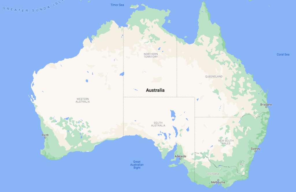
Data is available for 15,000 suburbs, local government areas and cities in 8 states/territories:
- New South Wales
- Australian Capital Territory
- Victoria
- Tasmania
- Queensland
- Northern Territory
- South Australia
- Western Australia
- Australia wide